Thursday, September 5, 2013

Half way home

Greetings from Little Rock Arkansas!  We are spending a couple nights here at my mothers house before we make the final push for home.  The internet is pretty fast so I thought I would get my maps caught up.

Our first day out of Santa Rosa, last Thursday, we made it to Austin, Nevada.  We had two interesting stops that day, the first was at the Donner Pass rest area and the second was at an old Pony express station on Highway 50.


Day Miles - 401
Summer Miles - 12,845

On Friday we drove from Austin, Nv over to Salina, Utah.  Nothing too exciting that day, just miles and miles on Highway 50, AKA, the loneliest road in America.  Don't believe me - well here you go.


There you have it, Highway 50 is the self claimed loneliest road in America.  


Day miles - 369
Summer Miles - 13,214

Saturday was a short day.  We only drove from Salina over to New Castle, Co.  We stayed with a friend of my old neighbor Ken Hayashi.  His name is Jim Kuhn and he grew up back in the triple cities area, attending Vestal high school.  We got to talking to Jim and it turns out his dad lives in Rotonda West, about 5 blocks away from our house.  Talk about a small world!


Day Miles - 280
Summer - 13,494

From New Castle we drove into Castle Rock where we had dinner with one of Kim's friends from her time in Colorado.  Then it was due east to Limon, Co. 


Day Miles - 265
Trip - 13, 759

 From Limon it took two more days to get here.  We stopped in Fredonia, Kansas the first night, then made it to North Little Rock on the second day.


Day Miles - 514
Summer - 14,273

Here's the last map for the first half (or more likely two thirds) of our tip back to Florida.


Day - 365
Trip - 14,638

It's been a long week to say the least.  We have been here in North Little Rock for two nights and are probably going to stay one more.  We will probably leave Friday morning and be back home on Saturday evening.

Thursday, August 29, 2013

Time to head home

It's been a great trip but it's time to go home.  We are headed back to Florida later this morning.  We estimate about 7-10 days to get back.  Thanks for following the blog, we will attempt to get some more posts up while we head across country.

Thursday, August 22, 2013

A little tundra golf in the Yukon

Greetings to anyone still following our adventures:

Todays pictures and video's are from August 5th up in the Yukon.  We woke up that morning at our favorite Whitehorse campground, Pioneer RV Park.  We headed east on the Alaska Highway then turned south on the road to Skagway.  Our first stop was the Annie Lake Golf Course.  This course is the definition of pasture golf.  It literally is carved out of the tundra just west of the Klondike highway.  The course costs $5 for 18 holes, on the honor system of course.  No starter, no golf carts and no grass!  A couple of the local rules include:  Bears and Moose have the right of way, if you loose your ball down a gopher hole (in the fairway) no penalty and make sure to drag the greens when finishing the hole.  The last one will make more sense if you view these pictures.  Video's 1-4 show Kim in action at the course.

From Annie's Lake we headed south on the Klonidke highway.  Our next stop was the Emerald Lake pull off.  As the name implies this lake is a beautiful green which you can see in video six .  From there we drove down to the worlds smallest desert, in Carcross.  The dogs had a great time sprinting back and forth in the sand, well for a short time they did.  Then they just enjoyed a nap.  Finally, we headed back to the Alaska highway via Highway 8, also known as Tagish road.  While driving up we saw a couple of really cool rainbows.  You can see them in videos 12 and 13 via the below link.

I put all of the videos for the day in one playlist which you can find here.

I also posted some pictures from Emerald Lake and Carcross.  You can find them here.

Kim and I are heading into San Francisco in an hour or so.  We have tickets for the Pittsburgh Pirates vs San Francisco Giants game tonight.

Wednesday, August 21, 2013

The Whitehorse fish ladder

Stories from the road.

Now that we are back and have reliable internet the plan is to upload video and pictures then do a short post describing what you are going to see.  Our first episode is from August 4th back in Whitehorse in the Yukon territory.  Kim does this thing called letterboxing.  Letterboxing is similar to geocaching in that you follow clues to find a hidden box.  The difference it that the box contains a rubber stamp.  You can read more about Letterboxing here.

We were headed out of Whitehorse towards the Damn on the Yukon river to look for one such box when we came across the local fish ladder.  The purpose of this fish ladder is to allow Salmon to get past a giant damn.  They have fish ladders all over Canada, this one claims to be the longest wooden fish ladder in the world!  We stopped at the dam/ladder and wouldn't you know it the first Salmon of the season happened to enter the ladder right then.  Of course, we have video of the event.

Here's the youtube link to 5 videos from the fish ladder.

Here's the link to some pictures we posted to Flickr.

You can view the online "Fish Cam" here.  Finally, here's a link to a pdf with additional information on the Dam and fish ladder.

Monday, August 19, 2013

Dempster Highway

Here are 16 video's from our North bound drive up the Dempster Highway.  Click here

And here's a link to a four minute video of a Caribou walking in front of our RV.  This guy was over on the Top of the World highway.

Teklanika River Hike

I've been busy uploading video's today.  During our visit to Denali we took a long hike up the Teklanika river.  Here's a link to 17 video's I made that day.

Back in California!

We got back to California last Thursday.  It's kind of depressing when a trip gets over so I haven't gotten my last post for this trip done until today.  I did manage to get a couple more video's posted up on youtube.  This link should take you to the most recent uploads.

On to the last few maps for the Alaska adventure.  Last Tuesday we drove from Harrison Hot Springs to Woodburn, Oregon.  We stayed at an interesting little campground right off Interstate 5 next to an outlet mall.


View Larger Map

That days' drive was 354 miles which brought our summer total to 11,861.  On Wednesday, we drove from Woodburn down to Mount Shasta, Ca.  We stayed at the Mount Shasta KOA campground.  This was where we spent the first night three years ago, when we did our first Alaska trip.


View Larger Map

Day Miles - 331
Summer Total - 12,192

Our final day out was last Thursday.  We drove from Mount Shasta here to Santa Rosa.


View Larger Map

Final Alaska trip day total - 252
Current Summer trip total - 12,444

What a trip!  What fun!  We are in the process of sorting through the thousands of pictures we have and hundreds of 1 minute on the road video's we shot this summer.  We will continue to post pics and videos as we get organized.

We will be here in California until at least next Wednesday, then we start back for Florida.

Monday, August 12, 2013

Coming to an End

We arrived in Harrison Hot Springs, British Columbia last night to a dismal climate with rain, lightening, and lots of thunder, but today proved to be a gorgeous, warm day. And as I sit here in our campsite, I'm saddened by the fact that the trip is two days from being completed. I just can't believe how fast the entire trip has gone-where in the world did seven weeks go? But then I realize that instead of being a bit sad because it's ending, I think about how lucky I am to have done this trip with Doug and especially my Mom. Not many people get to spend so much time with a parent later in their lives so I'm thrilled to have this opportunity. 

Traveling tends to change people from all the experiences, but then traveling so far North to Alaska, the Yukon, and the Northwest Territories really makes a tremendous impact. You learn to treasure moments each day that make you smile, laugh, or just cry because they add a little bit to your life story. One such moment was just over a week ago in Watson Lake, Yukon when we stopped at the Sign Post Forest. Back when the Alaska Highway was being built in 1942, a homesick soldier from Illinois placed a sign in Watson Lake with the name of his hometown and the distance back to that town. Little did he know what an impact his simple task would become because today over 77,000 people have placed signs in the "Forest" that have become a little part of their stories. So for the last two years, I have talked about making a sign and putting it up at the "Forest" and this year I did just that. I made a sign with all of our names on it, including the dogs, and together we put the sign up representing a little story of our lives. It was an overwhelming experience for me putting the sign up, but then I had to turn away because I was really crying when my Mom made us promise to revisit the sign in 50 years. It made me happy to have the sign there, but then I realized that maybe my Mom won't be here if we ever revisit our sign. But at least we have a sign up saying that yes we were here!  Here's a picture of the sign and us posing with the sign.


Another such impact on this trip was finally making the journey all the way to Tuktoyuktuk, Northwest Territories. Our hopes were dashed during the early part of the trip when the highway to Inuvik, Northwest Territories was closed, but then when the road reopened, I knew we had a chance to fulfill a dream. And we did it in style! The plane was only a four seater so we had the plane and pilot all to ourselves both going and returning. So when the pilot spotted four beluga whales, we were able to circle back to watch them for several minutes. Then we had the tour guide to ourselves which made it seem more intimate of a tour. I even got to stop at the post office to take pictures and mail a few postcards. In fact, the tour guide got a kick out of the fact that the postcards we mailed from his little post office were going to Florida and California. And finally the real thrill of the trip was being able to wade into the Arctic Ocean and freeze our feet of course!!! But I really don't know anyone else who has traveled that far north to the Arctic Ocean and put their feet into it's icy waters. And that part of the trip is another part of our story for the rest of our lives.

There are many more other adventures we've added to our story, but I guess what I want to convey is how important it is to experience life every chance you get. We get one shot at this so we have to make it count for something. And each day we experience anything, it becomes another piece to our story. I'm happy to have added many more stories on this trip; many will never be forgotten.

Thank you for joining us on this incredible journey. It's not over; it's just another new chapter.

Maps for the last week

We started last Sunday driving Whitehorse to Carcross then Teslin Junction.  This short hop, just over 100 miles for the day, pushed us over 10,000 since we left Florida!


View Larger Map

Day Miles - 139
Trip Miles - 10,104

Monday we drove from Teslin to the Liard Hot Springs Provincial Park.


View Larger Map

This was almost a 300 miles day.

Day Miles - 291
Trip Miles - 10,395

We spent three nights at the hot springs then headed east to Fort Nelson.  We went down for a morning soak and didn't leave until almost noon so we didn't get a lot of miles covered.


View Larger Map

Day Miles - 189
Trip Miles - 10,584

Saturday was our longest day in the RV this summer.  We drove from Fort Nelson all the way to Hixon, BC.  There is a little RV park there that we have stayed at twice previously so that seemed like a good goal.  Naturally, it being Saturday and all, the little RV park had no vacancies.  Lucky for us there was another park just down the road.  It wasn't as nice but it had been a long day and we were leaving early so we called it a night.


View Larger Map

Day Miles - 545
Trip Miles - 11,129

That brings us to today.  We left Hixon at about 10 am and drove here to the Harrison Hot Springs.  We are spending two nights here then we head for Santa Rosa.


View Larger Map

Day Miles - 378
Trip Miles - 11,507

So there's the update.  Over 11,000 miles so far!  It's around 900 miles back to Santa Rosa and a couple thousand miles give or take back to Florida.  We could make it to 15,000 miles this summer!

Sunday, August 11, 2013

We are back in Harrison Hot Springs


Wow - has it really been a week since our last post?  We have had fun and are back in southern British Columbia tonight.  We left Whitehorse last Sunday and drove down to the Annie Lake golf course.  If you weren't following this blog 2 years ago then you don't know that Annie's Lake is a golf course on the tundra of wild British Columbia.  Above is a picture of Kim getting ready to tee off and below you can see me lining up a putt.  I'll post more pictures when we get back to Ca.


From Annie Lake we headed south to Carcross then back up to the Alaska Highway.  We spent a night at Teslin Junction then drove over to the Liard Hot Springs Provincial Park.  We spent three nights there, enjoying the hot springs twice a day, then headed east again.  We made it from Liard to Fort Nelson on Friday.  The last two days have been long days on the road.  First we drove from Fort Nelson to Prince George, a little over 500 miles, on Saturday.  Today we drove from Prince George down here to Harrison Hot Springs today.  That was around 400 miles.  We are going to spend two nights here then we are headed back to California.  I hope to get caught up on my maps posted later today and tomorrow.

Sunday, August 4, 2013

Cloudy day in Whitehorse

We are back in Whitehorse today.  I was planning on playing some golf but it rained last night and it is cloudy this morning so not sure if that will happen.

The internet was good last night so I managed to get some more photo's posted.  Fifty six additional photo's from our flight and day trip to Tuktoyaktuk can be found here.  I also managed to get some pictures of Inuvik and our trip back down the Dempster highway posted.  You can find those pictures here.

The drive down from Dawson City was fairly uneventful.  We did see another Momma bear with two cubs but they bolted into the woods before we could get any pictures.  That brings our bear count to 23 for this years trip.  The last two years we had seen 30 bears each trip so it looks pretty good for breaking our viewing record this year.

The map for yesterday -


View Larger Map

Day Total - 331
Trip Total - 9,965

Saturday, August 3, 2013

Dempster Wildlife Report Card

Grizzly Bear - Check
Brown Bear with cubs - Check
Caribou - Check
Moose - Check
Red Fox - Check
Dahl Sheep - Check

Let's see - thinking . . . thinking . . .

Oh yeah, Beluga Whales - Check

Photo's are on Flickr.  Find them here.

Safely off the Dempster!

We are safely back in Dawson City.  On the way back down the Dempster we saw 3-4 vehicles with flat tires.  What a bummer for them.  We are headed to Whitehorse tonight so hopefully Kim will get a post together with details on our adventure.  This morning I am going to try to get caught up on the maps for our trip.  First, last Sunday we drove across the Taylor highway to Chicken, Alaska.  Then on Monday we drove over the Top of the World Highway here to Dawson City.


View Larger Map

2 day total - 387 Miles
Trip Total - 8,660

From there it was off to Inuvik!  Almost 500 miles each way.  We stopped at Eagle Plains and spent one night during each trip.


View Larger Map

It was about 487 miles each way!
4 days of driving the Dempster - 974 Miles
Trip Total - 9,634

We saw lots of wildlife on this segment!  More info and pictures next post.

Wednesday, July 31, 2013

What an adventure!

We made it up to Tuktoyaktuk today!  The weather was good, our plot was really cool and our guide gave us a great tour of the city.  We took close to 1,000 pictures but I am using the public library here in Inuvik so I don't want to hog there bandwidth to badly.  Instead, you can find the 10 pictures I did post here.

I have some catching up to do on the maps and I am sure Kim will want to post all the details but that will have to wait.  We should be in Whitehorse by the weekend and internet is usually pretty good there hope to get caught up then.

Meanwhile, here's a map of Tuk.  If you scroll down to the south on this map you can find our starting point in Inuvik.


Monday, July 29, 2013

It's a Go!!!!

I'm sitting in our campground in Dawson City, Yukon after having gone over the top-of-the-world highway from Chicken, Alaska today. If you remember back several weeks ago, we came to Dawson City in hopes of traveling the Dempster Highway to Inuvik, Northwest Territories, Canada, but the road was washed out. And as I said before, all my Mom wanted to do this year was to travel the Dempster Highway then take a flight to a fly in village, Tuktoyuktuk, Northwest Territories where she could put her foot into the Arctic ocean. So several weeks ago it seemed as if the dream wasn't going to work out, but things have changed and for the better. As we traveled throughout Alaska, we kept an eye on the weather for this part of the world and it looked better and better each day. Then we all made the decision to try this one more time before really giving up so I'm thrilled to announce that it's a go. Yeah!!!!!!

Tomorrow morning, Monday, we leave Dawson City for the 25 mile drive to the start of the Dempster highway. Our plan is to go to about the half way mark which is Eagle Plains, a town of about 8 people, then the next day finish the highway to Inuvik. The road is all gravel with two river crossings for a total of 417 miles from start to finish. Then once we arrive in Inuvik, we'll go to the Nova hotel to make plans for a Wednesday flight to Tuktoyuktuk. The flight is roughly an hour then we travel through the town to explore for several hours and of course we get to play in the Arctic ocean. Even as I write this, I cannot believe this is finally going to happen. I guess I didn't give up in my heart so I hoped our luck would turn around. And it did!!!!!

We'll keep you posted as we get wifi which will be spotty at best. But for now just wanted to give you a brief update as to some very exciting news.

Once again, I want to thank all of you for following along on our trip as it's been a great adventure. It's always fun to share the trip with all of you. Also, please feel free to leave us comments since it's fun to know what you have to say. Don't be shy-I know you want to comment!!!!!

Sunday, July 28, 2013

Hello from Ptarmig . . . wait how do you spell that?

Oops, we are actually in Chicken, Alaska.  We read a sign last night that had interesting facts about Chicken.  One of the facts was that the original settlers wanted to name the town after the local bird which "filled many pots" in this area.  Unfortunately, it seems no one could spell Ptarmigan hence Chicken was born.

We intend to drive until about 7 pm tonight.  That should get us at least to the Tombstone Territorial Park on the Dempster highway and perhaps North of that.  Assuming the Dempster is open we will not have internet access until at least Inuvik (Which is 400 miles of dirt road North of Dawson City).  Worst case, we won't have internet until we get to Whitehorse sometime towards the end of this week or beginning of next week.

A couple more interesting facts about Chicken before we head out of here.  The road is closed in the winter, only about 15 hardy souls hang in here year round.  The summer population "swells" to about 30 or so.  There are no cell phone towers here.  Kids do correspondence, no schools.  Finally, and most depressingly, there is not a flush toilet to be found!

Saturday, July 27, 2013

On the road to Inuvik once more

We start this morning here in Fairbanks.  We will hit the Farmers market again then it's off to attempt Inuvik once more.  This means another trip over the Top of the World highway!  Then Dawson City, then up the Dempster highway.  Hopefully it will be open this time.  It also means we probably won't have interent service for a week or so.

I managed to get the video of the Hyder, Alaska 4th of July parade posted on my first night here.  (The ISP was not amused, I got kicked off the internet for 24 hours for abusing the band width limits.)  If you have 6 minutes to spare it is quite the event.  You can find it here.

Here's the latest updates for our travel maps.  First, from the Visitors Center in Denali back to our Campground in Teklanika.


Day Miles: Almost 30
Trip Miles: 8,123

Next, here's the map from Teklanika up to Fairbanks.


Day Miles: 150
Trip Miles: 8,273

Wednesday, July 24, 2013

Denali was spectacular - again


For the third year in a row we happened to be near Mount Denali on a perfect day.  We took the shuttle bus from our campsite in Teklanika River out to the Eielson visitor center.  It was a cloudless day, one of only 2 such days this July.

We are back at Riley Creek now and have to get going but I wanted to get some quick information up.  A video from the Eielson visitor center can be found here.  A video from the Polychrome overlook on the ride out can be found here.

I also got some Flickr photos uploaded.  You can find several more pictures of Mount Denali as well as some wildlife we saw along the way here. Gotta run - off to Fairbanks tomorrow.

Saturday, July 20, 2013

First night in Denali - yes we saw the mountain again!

We have made it back up the Parks highway to Denali National Park.  Once again, we were lucky enough to the mountain.  As you may have read in this blog in last year or two we have been advised that the mountain is only visible about 20 days a year.  For the third year in a row we have been here while it was out.  This year, we only saw it from the RV as it was quickly clouded over.  I did manage to get some video of it but it's not on my computer yet so it won't be uploaded tonight.

We have our campsite for tonight set up and we have our passes for the drive out to Teklanika River campground tomorrow.  We have also purchased a bus pass that will allow us to go out to the Eielson Visitor Center on monday.  Eielson is 66 miles into the park and about an 8 hour round trip bus ride from our campground in Teklanika.  This is all very exciting!

There is a ranger program at 7:30 tonight so I am going to put this post up and then head over to that.  I did manage to get some additional picture posted on Flickr.  This link will take you to my sets page and you can see what the most recent uploads are.  The Homer and Salty Dog pictures are there for sure and the Alaska Wildlife Conservation center pictures are loading as I type this.  I am also hoping to get some additional video on youtube.  We have started a new series called One minute on the road.  In these clips I hold the Flip Video up and shoot out the front window for roughly a minute.  They are pretty shaky but it will hopefully bring you right into the RV with us as we travel around Alaska and Canada.  You will see the tag 1MOTR in front of these videos.  This link will take you to my recent uploads page on youtube.

Here's today's map;


Day total - 207
Trip Total - 8,093

Getting Ready for Denali

Tonight we are back in Palmer.  We spent 3 fun days down in Homer.  It was a bit cold and windy this year and there were way way more campers than in years past but we still had a good time.  Kim and I even got a bike ride in last night.  And, of course, we got into the Salty Dawg for a cold one before we closed out our stay in Homer.

The drive to Homer was fairly uneventful.  We stopped at the Alaska Wildlife Conservation Center and then at Beluga Point where we had lunch.  While we were at Beluga we saw some sheep high up on the mountainside.  The tide was also coming in so we saw some amazing whirlpools and tidal activity.  I have some video of the water (the sheep had to be viewed through binoculars so no pics of them) and Kim took lots of photo's - maybe we will get some posted later tonight.

As I mentioned in a previous post we have 5 nights lined up in Denali National Park.  We arrive tomorrow the 20th and spend the first night at the Riley Creek campground.  Riley Creek is the first campground at the park, situated right inside the national park boundary.  It is fairly close to the visitor center, we have stayed there each of the last two years.  The next three nights should be fascinating!  We have reserved a spot in the Teklanika River campground.  This campground is 29 miles into the park!  It is about 16 miles past the point where all private vehicles have to turn around.  The campground requires a three night minimum stay, and you can't move your vehicle once you arrive.  There is internet available at the store in Riley Creek but I highly doubt there will be access back in Teklanika River.  Assuming we do not get eaten by a bear or other wild animal we should be checking in next weekend.  If you haven't signed up to get notifications via email now might be a good time to do that.

Here's today's map:


Day Miles - 263
Trip Miles - 7,886

Wednesday, July 17, 2013

We made it to Homer

Good Morning from Homer Alaska;

We arrived yesterday and it's more crowded here this year than it has been for the last two years combined!  We will be here for the next two nights as well.  Which means two more nights to hang out at the Salty Dawg Saloon!

We left Fairbanks on Monday and drove down to Palmer.  We spent one night there and then continued on to Homer.  We have a beautiful campsite looking over Kachemak bay.

Fairbanks to Palmer;


View Larger Map

Day Mils - 329
Trip Total - 7,361

Palmer to Homer;


View Larger Map

Day Miles - 262
Trip Total - 7,623

We stopped to let the dogs out on our way down yesterday and there was a moose a couple hundred yards ahead of us. Kim and her Mom walked the dogs while I headed down to get some pics.  Most of them are great shots of the body, it was eating and wouldn't lift it's head up!  Internet is not so great here but we have lots of pictures and video to post.  Maybe we can find some place with fast internet and get some stuff posted in the next couple of days.

Friday we head back North - we have 5 nights reserved in Denali starting Saturday.  That part of the trip deserves it's own post so more later on that!

Monday, July 15, 2013

Leaving Fairbanks right now

It's 10:45 and we need to be out of this campsite by 11 so here's a quick post to recap our last day here in Fairbanks.  I finally got my round in at NorthStar golf course.  Played really well for me and I saw at least 2 moose and possibly a third one as well.  (The third sighting may have been the same one I saw the first time)  I didn't get a good picture of the second moose but I can tell you he was not happy to see me!  His ears stated twitching and he was staring me down so I took the long way around and had no problem.  You can see my scorecard here, and if you scroll down from the card you will see 10 or so pictures of the course and the moose!

While I was playing Kim got in about a 15 mile bike ride!  She rode all the way over to the Farmers Market and got herself a nice old school wood frame!  Don't tell her I said this but it is kind of cool looking.

Meanwhile, Gerry had a full day of reading her book and watching the dogs!  We are headed to the Parks highway and south towards Palmer.

Cheers!

Saturday, July 13, 2013

Things to do in Fairbanks - catching up on miles driven

Greetings anyone still checking in;

Today we find ourselves in Fairbanks, Alaska.  It is sunny and beautiful outside this morning.  There are several things to do up here.  Among the items we hope to get to are: the local Farmers Market, the Large Animal Research center, Creamers Field, (an old dairy that's now a bird sanctuary) and then possibly 18 holes of golf later this afternoon.  Word has it that you can make tee times up to midnight, unfortunately, I can't seem to stay awake that late any more so if I go it will have to be earlier.

We drove up from Tok yesterday, here's the map:


Kim reminded me that I was putting up the daily and total mileage with my cross country posts.  I seem to have forgotten about it since we left Santa Rosa.  I am going to take advantage of our fast internet here to get caught up.

Yesterdays drive was about 202 miles which brings our trip total up to over 7,000 since we left Florida!


I have already posted maps for the drives listed below so I'll just put mileage totals here;

Santa Rosa to Rocky Point Resort in Oregon - Day Miles 398 - Total since we left Florida 4,100

RPR in Oregon to Viento State Park - Day 288 - Trip 4,388

Viento to Harrison Hot Springs - Day 371 - Trip 4,759

Harrison to Hixon, BC - Day 378 - Trip 5,137

Hixon, BC to Kitwanga, BC - Day 337 - Trip 5,474

Kitwanga, BC to Hyder, Alaska - Day 186 - Trip 5,660

Hyder, Ak to Deese Lake, BC - Day 253 - Trip 5,913

Deese Lake, BC to Whitehorse, Yukon - Day 396 - Trip 6,309

Whitehorse, YK to Dawson City, Yk - Day 331 - Trip 6,640

Dawson City, Yk to Tok Junction, Alaska - Day 190 (ish) - Trip 6,830

Tok, Ak to Fairbanks, Alaska - Day 202 - Total 7,032

It's 10:30 p.m. and I need my sunglasses!!!!

Greetings from Fairbanks-the interior of Alaska and land of the midnight sun

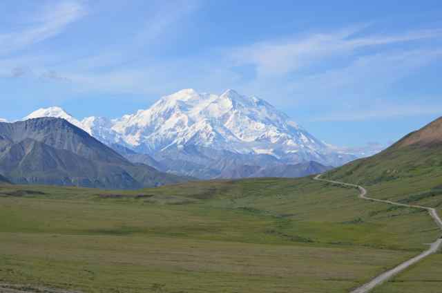
We technically stepped into Alaska on July 4th, but we really arrived into the main part of the state yesterday after leaving the Yukon Territory. Getting to the state of Alaska takes a lot of patience and many, many miles of driving every kind of road you can imagine. There are lots of paved roads, but then there are parts with gravel only, torn up pieces of gravel and road base, construction galore, and everything else in between. But having finally arrived into Alaska and seeing all it's beauty makes all those miles worth it.

I know Doug has been posting quite often to keep you all up to date, but I thought I would fill in the blanks as to the actual details and such. First of all, I'm really upset and sad because as of now, we can't get up to the Arctic ocean which was my Mom's biggest dream this year. In order to actually get to that part of the world requires a trip up the Dempster highway which is about a 400 miles dirt and gravel road to Inuvik, Northwest Territories. The road passes through some incredibly gorgeous country that seems unreal with all it's beauty. At the end of the Dempster brings you to the town of  Inuvik, and from there you take a one hour plane ride to Tuktoyuktuk. The town of Tuktoyuktuk lies right on the Arctic ocean where you take a tour which includes a visit to the town's ice house constructed out of the permafrost. Plus the tour  actually takes you to the ocean where you can join the polar group by putting your foot, half your body, all of your body, or your body and no clothes into the Arctic ocean.  Crazy huh? Just seeing that part of the world has been on my Mom's bucket list for quite a while and now we may not be able to go. Why? Being this far up north means that you live life according to the weather and the conditions around you and that being said, the Dempster highway is currently closed. There are two river crossings by ferry and they are closed due to high winds. Plus there has been a lot of rain so there are several washouts on the road which makes it impassable. So for now, until something else changes, Tuktoyuktuk is not within reach and that breaks my heart. My Mom never asks for much and this was something she looked forward to all year. Maybe something will change and the road will reopen plus we'll have time that we can still make this happen. All I remember my Mom telling me last year was that she was afraid she would die and not see the Arctic ocean. Sorry to go on and on, but as you can tell, I'm so frustrated and saddened so thank you for listening!

We left Dawson City, Yukon early, and I mean early, Thursday morning for Alaska. There was a caravan in our campground of about 24 RVs that were leaving Dawson City and the ferry over the Yukon river only takes about 2-3 RVs at a time so we thought it best to get out of there before the big backup and possibly a 4 hour wait. But getting up so early was a little tough! We did make it across the river though and funny enough, we were the only RV on the ferry. It was great.

The road to Alaska from Dawson City is called Top of the World highway and it lives up to it's name and then some. At every turn there are incredible views of the Yukon river and valleys below. The road is mostly gravel with some paved areas, but overall it's a great road. You actually feel like you're on top of the world with such expansive views all around. Then about 65 miles down the road is the US/Canadian border. The US border, as you can see from our pictures on flickr, is the northern  most border in the US with only 2 people living there. Now, who do you think the border agent pissed off to get that post? I mean it's in the middle of nowhere, only yourself and one other person, and during the summer, the temperatures average about 40 degrees. But thankfully for the agent, the border closes during the winter as the road gets many feet of snow for about 8 months.

The first town after crossing the border into Alaska is Chicken which is a town but not a town. There are maybe 25 people or so living there during the summer months, but maybe 10 at the most during the winter and it's usually cold year round. There's a post office, several RV campgrounds, a gift shop, and a restaurant or two, but that's about it. And how it got the name of Chicken you ask-well it was originally called Ptarmigan, but nobody could spell it hence it became Chicken. I always love that story!!

From Chicken, we arrived into a town called Tok which is famous for all the dog mushers living there. It's really not much of a town, but it's the first real town you get to once you arrive into Alaska. It's also known for it's incredibly cold winter temperatures which average about 20 to 30 below in January through the end of winter. Now those are some hardy people and I know I couldn't do it.

And after all that, I'm finally caught up to today and what's happening!!! We arrived here in Fairbanks this afternoon with incredibly gorgeous hot weather in the 70's. Finally some warm weather up north! Our campground is really beautiful as it lies right along the Chena river, which runs through Fairbanks, where there's a lot of wildlife, like the momma duck with her five ducklings that have been swimming by countless times, in addition to many locals going up and down the river in aluminum boats, jet skies, kayaks, rafts, and canoes. And this is where I'm sitting now, right along the river watching the locals enjoy this beautiful evening. It's 11 p.m. now and the sun is still shining strong which is still amazing to me. This far north, the sun is out for about 22 hours a day and that's what makes Alaska so fun in the summer. And yes, it's opposite in the winter so they get about 22 hours of darkness with average temperatures of 40-50 below zero. That means that between the summer temps and winter temps, there's a variation of over a hundred degrees!! The only problem is that when you get up in the morning, you think it's 7 a.m., but in reality it's usually only about 2 a.m.!!

Tomorrow we head to the farmer's market in Fairbanks which is awesome to experience. There is quite a lot of pottery, jewelry, soaps and lotions, plus the best feature is the gigantic vegetables grown locally. Because the area get about 22 hours of sunlight a day, the vegetables grew to immense size sometimes breaking records for their weight. We'll take pictures tomorrow as we explore the market so you can get an idea of what I mean. Then after the market, we'll take a trip to the other side of Fairbanks for an up close view of the Alaska pipeline. You can walk right up to the pipeline which in this day and age always amazes me. I guess they must have cameras all around because it's such a vital piece of the economy.

So as the sun goes behind the spruce trees with no sunset in sight, I bid you all a good night! Thank you everyone for following along with us on this adventure of a lifetime. Also, please feel free to comment on any posts plus if there's something more you would like to know or see, let us know. I'm just loving that we have all of you along for the ride, but I really enjoy hearing from you even if it's just to say hello. I hope you all have a great weekend wherever you are and we'll be in touch tomorrow. I guess I can take off my sunglasses since the sun is behind the trees for now!!!

Friday, July 12, 2013

The Dempster was a washout - literally!

11:07 update - Top of the world photo's

Well, turns out the Dempster highway was closed - again, we couldn't get up to Inuvik last year either. Soooooo, we changed plans and we are at Fast Eddy's in Tok Alaska having breakfast this morning.  Back to the Dempster, high winds closed both Ferries on the highway and we also got word that there was at least one washout of the road.  Oh well, we might try again in a couple of weeks.

Today we are headed to Fairbanks, we will be spending three nights at the River's Edge RV park.  The weather is supposed to be great this weekend so hopefully I'll get to play some golf.  The North Star golf course which advertises itself as the northern most golf course in America.

Here's the corrected map for our journey over the top of the world highway yesterday.


Well almost corrected, turns out google maps doesn't know about the Top of the World highway in Canada!???  We actually drove from point A, to point B (which is the legendary Chicken, Ak) and then down to C.  It was only about 200 miles not the roughly 800 or so this map shows.

Internet is usually good at the Campground in Fairbanks but they limit up/downloads.  We will try to get some pictures posted.

Wednesday, July 10, 2013

Bear 4 on this trip

Greetings from Dawson City;

We saw our 4th bear of the trip yesterday.  He (or she) was just hanging on the side of the road.  We stayed next to it for a while but couldn't get a really good photo.  This was the best one of the bunch;


The Cassiar highway was a bit of disappointment wildlife wise.  We only saw 3 bears, none of which we even managed to get one photo of.  We also did not see any moose or other big game.  Scenery, of course, was spectacular as you can see if you view our flickr photo's.

The big news is we managed to secure a reservation for the flight to Tuktoyaktuk on Saturday!  There is an arts festival in Inuvik so we thought perhaps all the trips would be booked however that was not the case.  Now we just have to get up the 400 miles of dirt road to Inuvik and hope the weather stays good.

Here's the map for our trip from Whitehorse to Dawson City.


Since we may not have internet over the weekend I'm going to post a couple more maps here.   First, this is the Dempster highway, the road we will be taking to Inuvik.


Finally, here's a map that will show you where Tuktoyaktuk is located.  Among the activities that our trip includes is a polar bear plung into the Artic Ocean.  We should have some photo's of that and perhaps a video sometime next week.


Tuesday, July 9, 2013

Youtube videos

Well, it was kind of grey and cold here in Whitehorse so I didn't go play golf.  We did go into Whitehorse where we had a nice lunch at Tim Horton's, laid in some supplies at Wal-Mart got gas and then Kim and her mom got a little shopping in. Tonight, we are hanging out in the campground and the internet here in the office was fast enough that I managed to get some videos posted.  Due to band width limitations that campground actually blocks youtube from loading so I can't provide that direct link to each video.  This link should take you to my page where you can locate the new videos.

One of the videos I managed to load was 6 plus minutes of the Hyder July 4th parade.  It was certainly eclectic and well worth the time to give it a view.  I also have videos of downtown Hyder and Salmon Glacier up as of 9:50 pm here in the Yukon Territory.

The current plan is to head to Dawson City tomorrow morning and then up to Inuvik for the weekend. However, we recently became aware that there is an arts festival going on in Inuvik this weekend.  If we cannot get a campsite reserved or if we can't get the sightseeing flight to Tuk we may end up heading for Haines Alaska instead.  We plan to get on the phone tomorrow to determine which way we will be headed.

Monday, July 8, 2013

Cool, we have electricity tonight!

We have made it up to Whitehorse in the Yukon territory of Canada!  We are camped at the High Country RV park on the east end of town.  It is a real treat to be here!  Last night we spent our first evening on this trip without electricity.  We stayed at the Waters Edge RV Park near Deese Lake on the Cassiar highway.  It was a nice little park but NO hookups, which means that in addition to no electricity there was no hot shower this morning - bummer!

We had a nice drive up today. We stopped at Jade City, a souvenir shop on the Cassiar.  As you can probably guess they have all kinds of Jade products.  What you probably did not know was the something like 92% of the Jade in the entire world comes from that particular area!  Pictures from our tip up the cassiar are here.

I also added some additional photo's from our trip to Salmon Glacies from Hyder.  You can find them here.

Tomorrow Kim and her Mom are heading into Whitehorse for some shopping.  I plan to head to the Meadow Lakes golf club to get a round in.  It would seem that Meadow Lakes doesn't have a web site so this review from Yelp is the most info I can provide.

Here's a couple maps for the last 2 days of driving.  Day 1 Hyder to the Waters Edge Campground.


Today we drove from Waters Edge to Whitehorse..


Saturday, July 6, 2013

July 5th in Hyder and Stewart

Just got some pictures posted of our last night here in Hyder.  We started the evening at the Seafood Express bus, one of the only restaurants here.  We had a Captains choice platter which included 1 piece of Halibut, 1 large scallop, 1 deep fried oyster and 6 breaded shrimp.  The place is pretty eclectic, you can read more about it here.

After dinner Kim and I decided to bike to another country, which means we rode over to Canada.  We wander around the town of Stewart and then stopped at a tourist shop where they had a cut out mountie that we could pose behind.  While we were goofing off there a real mountie pulled up and volunteered to be in the picture's with us!  What a nice guy.

After that we rode back into Hyder and hung out at the Sealaska Inn and Bar.  The bar is open until 5am!  We only stayed until around 11:30pm.

I also got another set of pics posted.  They are from our drive from Moricetown to Hyder.

I'm trying to only post pictures that have GPS tags so you can see where they were actually taken.  Somewhere in Flickr there is a maps page that will show those locations.

The road to Whitehorse in the Yukon

We will be heading north once again later this morning.  The plan is to get to Whitehorse in two days. This may not be possible as there is a whole lot of highway between here and there.  We are also not sure what kind of road conditions we are going to find.  We hope to get about 300 miles in today, here's a map to give you a rough idea of where we will be driving.


We will be stopping at the visitor center over in stewart on our way out so hopefully I can post some more pictures later this morning.

Friday, July 5, 2013

Two Days in Hyder, Alaska

We got to spend July 4th and 5th here in Hyder, Alaska, a town of about 100 people just across the line from Canada.  Yesterday they had what can only be described as a unique 4th of July parade.  I have the whole thing on video and tried to upload it to you tube last night but, after about 90% of it loaded the internet seemed to cut out so it didn't complete.  I will try to get it posted tomorrow as we will be stopping by the Stewart, Canada visitor centre (that's not a type, they spell center funny in Canada) tomorrow.

Today, we drove 20 miles back "into the wild" to visit the Salmon Glacier.  What an incredible site!  It was a dirt road and it has been really hot and dry up here so it was very dusty but the views from the top of the mountain were incredible.

I think I was able to get some photo's of the parade, the glacier and the town posted over on Flickr.  You should be able to see them here.

Because the weather has been so awesome we have decided to head for Inuvik at the beginning of the trip instead of the end.  We hope to get to Whitehorse and then Dawson City in the next 3-4 days.  From Dawson City it's about 200 miles of dirt on the Dempster Highway to Inuvik.

It doesn't get dark until about 11:30 around here so Kim and I are off for a bike ride.

Thursday, July 4, 2013

Updating some links

It seems I messed up my links on yesterdays post.  I also got some additional photo's posted last night.  Here are some updates:

Oregon and Washington

Hot Springs Parade

Harrison Hot Springs

Photo's from July 2 and 3 in British Columbia

The youtube link was correct.  Here it is again if your interested.  Video's from the last couple of years are also available over there.

We have a short drive planned for today, we head into Alaska for the first time on this trip as we are planning to spend two days over in Hyder.


There is supposed to be a really great place to view bears over there so we are hoping to see some in the next day or so.

As always - thanks for reading!

Wednesday, July 3, 2013

We quit early today

We didn't make it all the way to Kitwanga after all.  We find found a delightful little campground here in Mauricetown Moricetown, B.C.  The internet seems to be pretty quick and they have free firewood and showers - a definite plus up here where we have paid as much as $2 (Canadian) for a 3 minute shower.

On the down side, we are only about a mile and a half from this sign.


Here's the actual map for what we accomplished today.


Tomorrow we should be back in the Good old USA - We head for Hyder, Alaska

Photos and You Tube video

Hello;

I managed to get some photo's posted to Flickr and some video posted to youtube.

You can see the videos here.

Pictures from Oregon and Washington are here.

Pictures from the Parade in Harrison Hot Springs are here.

Greetings from Vanderhoof, Ca

We are making a quick stop in this small town on highway 16 in central British Columbia.  We enjoyed a fun Canada day down in Harrison Hot Springs.  We started the day with a pancake breakfast at the local firehouse, then enjoyed the parade and fireworks later that evening.  It being Canada and all naturally we saw a Sasquatch.


He seemed pretty harmless.  We have some video from the parade that I will also post if we get some fast internet along the was

Yesterday, we drove from Harrison Hot Springs to Hixon.  Here's the map.


We left Hixon at about 9:30 this morning and our final destination for today is in Kitwanga, B.C.  That's still about 250 miles from where I sit right now.  Here's the map for that.


The road we are traveling has a rather notorious reputation.  It is known as the Highway of Tears as their seems to be a serial killer praying on young woman in this area.  

We plan to be in Hyder back in the good ole USA for Friday and Saturday.